


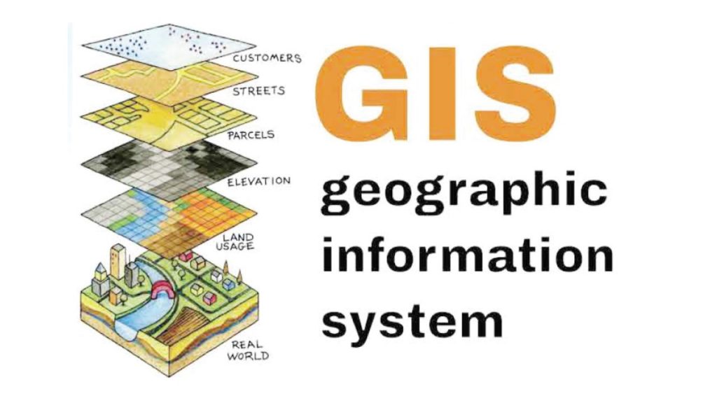
A Geographic Information System (GIS) is a framework for gathering, managing, and analyzing data.
Rooted in the science of Geography, GIS integrates many types of data. It analyzes spatial location and organizes layers of information into visualizations using maps and 3D scenes.
How GIS Works
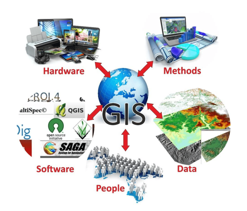
GIS Technology applies geographic science wit h tools for understanding and collaboration. It helps people reach a common goal: to gain actionable intelligence from all types of data.
Hundreds of thousands of organizations in virtually every field are using GIS to make maps that communicate, perform analysis, share information, and solve complex problems around the world. This is changing the way the world works.
many GIS integrates many different kinds of data layers using spatial location. Most data has a geographic component. GIS data includes imagery, features, and base maps linked to spreadsheets and tables.
Analysis
Spatial analysis lets you evaluate suitability and capability, estimate and predict, interpret
and understand, and much more, lending new perspectives to your insight and decision-making

Recent Comments